Editorial guide

The best hiking trails in Lanzarote

If you're looking for the best hiking routes in Lanzarote, this selection brings together six trails that are truly worth your time: volcanoes, cliffs, long traverses and historic paths with views over the Atlantic.

This isn't a list designed to tick places off a map without context, but an editorial guide to help you choose based on the kind of experience you want: a volcanic morning, a panoramic route, a descent to the sea or a demanding traverse with a sense of adventure.

And if you'd rather do it with local support, at the end of each route you'll find direct access to the guided hiking page so you can book with a guide according to your level and the day's conditions.

Editorial route

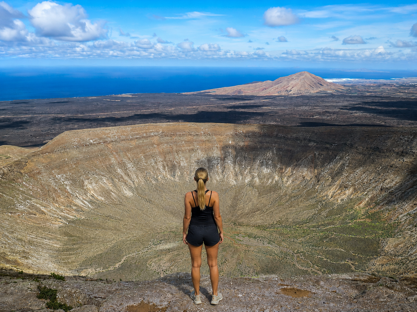
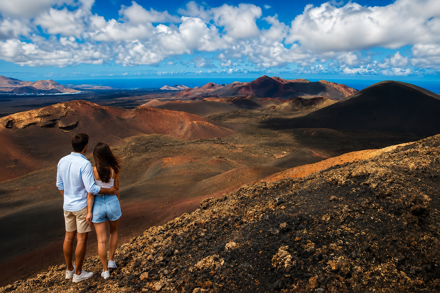
Caldera Blanca — the great volcanic classic

Loop trail · 9.5 km · 3–4 h · easy / moderate level

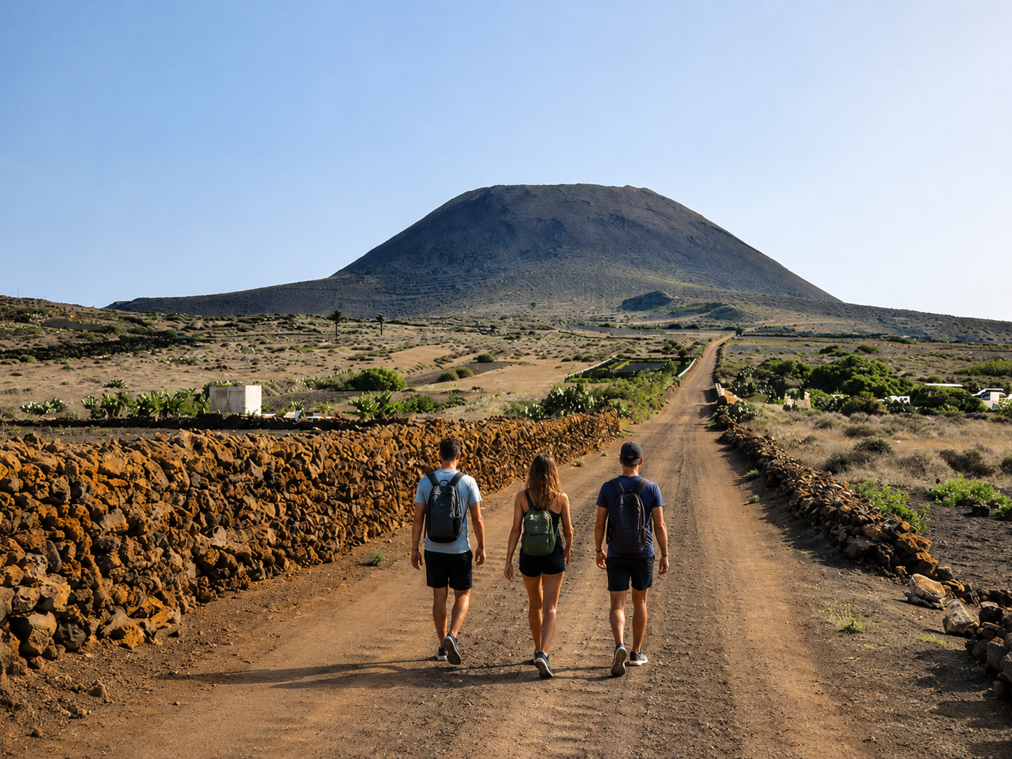
If you want to start with a route that explains Lanzarote in a single morning, Caldera Blanca is usually the first recommendation. You walk between lava flows, cross an open landscape and finish by looking into one of the island's most spectacular craters.

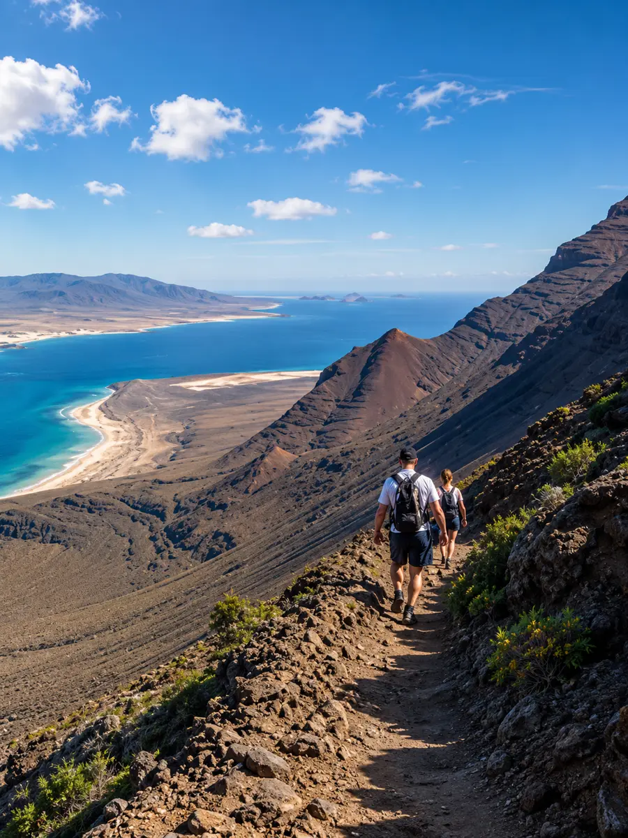
It's a very rewarding option for occasional hikers and also for active travelers looking for a strong volcanic route without needing a high technical level. With a guide, it makes even more sense: you understand the landscape better, choose the right pace and get more from the views around Los Volcanes.

Book guided route
View from the rim of Caldera Blanca in Lanzarote

Editorial route

Volcán de la Corona — the great viewpoint of the north

Out and back · 6 km · 2–3 h · easy level

The climb to Volcán de la Corona is one of those short routes that pays off quickly. The ascent is manageable, the terrain usually isn't too demanding, and the reward comes at the top: from here you can understand the geography of northern Lanzarote and the origin of the huge lava tube that feeds Jameos del Agua and Cueva de los Verdes.

It's an ideal route for those who want a panoramic, well-balanced experience that's easy to fit into a day exploring Haría, Yé or the north coast. It also works very well for active families and for travelers who want to combine nature, viewpoints and minimal logistics.

Book guided route
Hiking trail towards Volcán de la Corona in Lanzarote

Editorial route

Camino de los Gracioseros — the historic descent to the sea

Out and back · 7 km · 3–4 h · moderate level

Few routes have as much character as Camino de los Gracioseros. The trail descends from the area around Yé to the beach below the Risco, following the old path that connected Lanzarote with La Graciosa for centuries. Each section feels different: height, silence, stone, sea and a very special perspective over the Chinijo archipelago.

It's not an especially long route, but it does require attention to the terrain and enough energy for the climb back up. That's exactly why it's best enjoyed with a well-planned outing: the right schedule, a steady pace and an understanding of the north wind, which can greatly change how the route feels.

Book guided route
Panoramic view of La Graciosa from a long-distance trail in Lanzarote

Editorial route

Risco de Famara — the island's most dramatic cliffs

Linear / out and back depending on section · 8 km · 3 h · moderate level

For many people, this is the route with the best views in Lanzarote. Risco de Famara offers a huge panorama of the beach, La Graciosa and the entire northwest coastline. It's not so much a shaded forest walk as an airy, open route deeply shaped by light and wind.

It's perfect for those who value scenery and photography more than pure elevation gain. On clear days, the sense of openness is incredible. With a local guide, you can also choose the best section for your level and the conditions of the day, avoiding the times and areas where the wind makes the experience more difficult.

Book guided route
Hiker looking over Famara beach from the top of the cliffs

Editorial route

Famara – Órzola traverse — the long route for real hikers

Traverse · 18 km · 6–7 h · advanced level

This is one of Lanzarote's great hiking days. It links the Famara area with the island's northern tip in a long, scenic and physically more serious traverse. There's distance, wind exposure, plateau sections and logistics that should be planned carefully before setting out.

It's not the kind of route to improvise on the go, but it is a very powerful experience for those who want to see a wilder, less fragmented Lanzarote. If you're looking for mileage, a true traverse feeling and a route with character, this is usually the most complete option.

Book guided route
Sea view from a rocky cavity on a northern Lanzarote trail

Editorial route

Timanfaya on foot — the island's most singular experience

Guided route · up to 10 km depending on permit · moderate level

Walking through Timanfaya is unlike any other route on the island. The value here isn't only in the physical effort, but in the territory's strangeness: geologically recent lava, mineral silence, impossible shapes and the feeling of standing inside the volcanic episode that defined Lanzarote.

Because access on foot is tightly regulated, it's an experience that should be planned well and approached with the right expectations: less 'free hiking', more landscape and geological immersion. That's exactly why it works so well as part of a guided experience, where context makes each section far more memorable.

Book guided route
Volcanic landscape of Timanfaya in Lanzarote with hikers looking at the craters

Frequently asked questions

What's the best hiking trail in Lanzarote?
Caldera Blanca is the absolute favorite — spectacular, accessible, and perfectly represents the island's volcanic landscape. For sea views, Camino de los Gracioseros. For something more demanding, the complete Famara-Órzola trek.
When is the best time for hiking in Lanzarote?
October to April. The climate is temperate (20 – 25 °C during the day) and there is green vegetation after winter rains. Summer (July – August) is only viable early morning or evenings — the sun and lack of shade make long routes tough.
Are there easy hiking trails for families?
Yes. The Corona Volcano and the first half of Caldera Blanca are perfect for families with children aged 8 and up. Also, the Tremesana routes in Timanfaya (with an official guide, 3 km, almost no elevation gain).
Do I need a guide for hiking in Lanzarote?
For Timanfaya, yes — it is mandatory. For other routes, it is not mandatory but highly recommended if you don't have experience: local schools know the wind conditions, dangerous cliff sections, and the geological history of each area.
What do I need to bring for a route in Lanzarote?
Trekking shoes (no sneakers — the volcanic gravel is slippery), water (1.5 – 3 L depending on the route), cap, SPF 50 sun cream, windbreaker (always, it's windy all over the island), light food, and an offline map or GPS. In summer, sunglasses and neck protection are mandatory.
Can you hike in Timanfaya?
Only with an official National Park guide and prior reservation. Scheduled routes (Tremesana, Coastal) are free but have limited spots — book weeks in advance on the park's website.

Guided hiking in Lanzarote

Now you just need to pick your favorite

If you already know which route you want — or you'd like help choosing the right one based on your level, the wind and the time of year — you can book your guided experience directly from the hiking page.

Book your favorite route with a guide now